Singletrack heaven: La Thuile

Mmmm, coffee

With the best trails in Chamonix busy with walkers and trail runners, a (nother) road trip was in order, this time through the Mont Blanc tunnel to La Thuile. The trip’s an easy 45 minutes (if you don’t get stuck in traffic….) and stress free once you’ve found the chairlift (look out for the “bikers welcome” sign on a café, and turn next left!)

Chairlifts: easier to see than find.

A quick summary if you just want to look at the pictures: if you’re on a DH bike, best to stay on the main road till you hit Aosta, then ride Pila, or keep going over the pass and ride the Val d’Isere track, there’s nothing we found that warranted a big bike. There’s no big drops, jumps, rock gardens or braking bumps. If you’re on an enduro bike then best to visit Via Marcello Collomb and look in the estate agents window for a flat as your bike is pretty much perfect for every trail here. Hardtail riders needn’t worry either, the trails aren’t buffed smooth, but you’ll not struggle.

So, 17euro later and armed with the tantalising looking piste map (is it piste or trail? Either way, track names and letters below) we hopped onto the Bosco chair and gained 617m to discover that it were a bit chilly, and perhaps we’d better head back down and grab another layer. The black run “Garin / B” was the first to be found so followed that. We were disappointed. Heading back up (with long sleeves for me) we continued up another 261m on the Chalet lift and dropped back down on the red “Freeride / H”. Again, it’s not that the trail was bad, just nothing on a par to what we have here in Chamonix. Back up again we headed off to do a longer loop back down to town. This was more like it, fast and flowing singletrack through alpine scenery, getting more and more tech and tight as we dropped into the trees, before finally cruising back into town on the road. From here on in the day was on!

It's (almost) all this good, photo by Lorne Cameron

We kept doing top to bottom laps on all manner of excellent singletrack, very rarely climbing but generally requiring enough pedalling to make a full on DH or freeride bike too much work. Most of the trails are man-made, but with a really natural feel. The advantage of this is that they don’t seem to get too cut up. Occasionally the trails are obviously man made with berm and kicker sections, but these are few and far between.

Some scenery too. Photo by Lorne Cameron

I can’t think of another uplift area with such easy enduro riding, just get on the lifts, pick a trail, ride down, & repeat! A quick look at the piste map shows that you can easily mix and match sections of trails creating even more variety. And as with all bike areas, there are lots of locals trails cutting off the main paths but we never felt the need to check any out, this time….

Rather than describe how gosh darn awesome our day was and explain each lap in detail, here’s a breakdown of most of the trails we rode:

Lorne surfing the dust on Garin

Another day, another dusty trail....

Black Garin / B, average, dusty, bit rooty but not very hard.

Hanging out at the top of "Freeride" Photo by Lorne Cameron

Red Freeride / H, average, bitty, some braking bumps

Angus leading down on Foyer

Blue Foyer / I into red Argillien / J then black La Joux / C. More like it! Super fun, more open at top on Foyer & Argillien, very natural feel despite being mostly man made.

Smashing the, err, smashing berms on Le Tour, Photo by Lorne Cameron, top model's own

Red La Tour / P. Great again, though some muddy bits…. feels very natural till an out of character, but great, berm/jump section.

Angus on Touraisse

Touraisse / S. Faster of the 2 tracks leading on from La Tour, with some very very good drifty corners through just wide enough gaps in the trees.

Angus above La Joux on the imaginatively named, La Joux

Black Le Volpi / D. Good, much faster and more flowing than Garin, the other front face black, but probably a nightmare in the wet!

Obligatory double track-double whip

Blue Laghetto / L is mostly undulating double track with a very Scottish section on open heathland. Not a particularly interesting trail, but very worthwhile to access….

K trail of the day

Black Maisonnetes / K & Ponteilles / K2(deviation). K for Killer! The turn off from Laghetto is easy to miss, but keep an eye out on the right after the left hairpin and you’ll be fine. Trail of day with a great mix of all terrain, views, some tech and lots of fast flowing riding.

After the meadows on Verney, photo by Lorne Cameron

Red Verney / T. Other option for continuing on from Le Tour. More loamy than rest of trails, but could do with a bit more gradient in sections to improve the flow, track a little indistinct through meadows, but still good. Black link closed at Pont Serrand, so a short climb on road onto Le Volpi is needed of you don’t want to follow the tarmac down.

Bike park dual slalom

Bike park. Above the Bosco lift there’s a small bike park with dual slalom course (2-0 to Angus) some larger tables, a kiddie north shore and a (deflated) airbag. Nice way to finish off a lap, but it’s not Leogang.

Whetted your appetite? If all this riding isn’t enough then remember, it’s Italy, so don’t bother with a sandwich in the bag, just buy some panini, drink some coffee and the day will have been worth it no matter if you didn’t enjoy the riding (or your bike had a tantrum and got 4 punctures….) There’s even a “MTB Lunch” deal where you get your lift pass, lunch and a swim in the mid-mountain pool for 25.50!

#1 of 4!

See you there next year.

Sorry about the top folks, it was cold. Photo by Lorne Cameron

Ultra! (wet)

I’m not really sure what the trail conditions are about Chamonix at the moment, for the last week everyone’s been too busy with the 4 Ultra Trail races, either working, supporting or competing. Using my powers of deduction however, I can predict that biblical quantities of rain + the first of the autumn snows = fairly grim conditions. So if you’re heading out, best pack spare brake pads, spare shoes, spare waterproofs and a spare sense of humour for the slippy trails. Those living in the valley will resort to the usual spare liver techniques until normal service is resumed.

Huge congratulations to everyone involved in any of the 4 races, and especially Colin Thornton & Fred Yong, you guys are machines!

Time gentlemen, please

Chatelard descent Claire

It’s been raining, some of the trees in the valley have started to yellow and town’s filling with ultra-runners, it can only mean one thing: the summer’s coming to an end, and the lifts shut down till the snow comes.

The Chamonix lift closures are staggered across the next 2 months:

VALLORCINE: 2nd Sept

PRARION: 2nd Sept

BREVENT CABLECAR: 2nd Sept

LE TOUR GONDOLA & CHAIRLIFT: 9th Sept

GRANDS MONTETS: 9th Sept

PLANPRAZ GONDOLA: 16th Sept (then Oct 27th to Nov 7th)

FLEGERE: 16th Sept

BELLEVUE: 23rd Sept

TRAMWAY DU MONT BLANC: 23rd Sept

What’s not mentioned is that the Vallorcine DH track, & gondola for bike uplift, closes for the season on Friday due to the Ultra Trail races, so anyone wanting to hit every lift in the valley in a day better get cracking. If you’re looking for a race to end your Chamonix biking season then conveniently the Club des sports de Chamonix have organised a 24hr VTT race in the valley over the weekend of the 22nd/23rd September. For more information click

Vallorcine valley

Outside of the valley, lift closing days start from the end of August and by October Champery & Verbier are pretty much your only choices (though Brevant’s back open again by then, which is nice.)

Grand Massif, started closing on the 26th, all done by 31st Aug: http://www.grand-massif.com/ete/accedez_tarifs.php

La Thuile 2nd Sept : http://www.lathuile.net/datapage.asp?id=41&l=3

Portes du Mont Blanc, 2nd Sept : http://www.combloux.com/en/activities/summer/pass.html

Tignes / val d’isere 2nd Sept (still FREE up till then!): http://www.tignes.net/en/summer-sports/free-and-unlimited-activities-252.html

Pila, 9th Sept:  http://aostavalleyfreeride.com/index.php with desarpa bike mass dh the weekend after 15th/16th http://www.piladh.eu/en/desarpa-bike/

Portes du Soliel starts closing the weekend of 02nd September and is mostly closed by the 9th, except Champery which keeps going to 7th Oct: http://en.portesdusoleil.com/summer-lifts.html

Verbier 17th Sept, then weekends till 20/21st Oct (if weather’s ok): http://www.verbierbikepark.ch/

As for conditions in the Chamonix valley at the moment, the complaints about the temperature and lack of rain have been answered and there’s been a few days of drizzle and a day of torrential rain. My friend Claire had come over for the weekend to get a break from the Scottish summer in Chamonix, fortunately she packed the goretex.

Le Tour back bowls

The skies cleared up on Sunday and, despite a cold grey start, the quick drying trails at Le Tour ensured normal summer service was resumed. The weather is still a bit cooler than it’s been of late, so things are not drying quite as fast as before and as a result there’s lots more grip on the trails. The natural trails are still very busy, though with the Ultra Trail Mont Blanc being at the weekend, the pedestrians are generally moving faster than the cyclists so it’s not the same problem, and in one week it will all be different…

le tour & cloud

Aye Grand, Massif

too hot

First things first. It’s been really hot in the alps, and dry (It still comes as a surprise to a Scot that very dry = very little grip on singletrack, but that’s basically what condition the trails are in everywhere this week.) Very little grip and you have to either be first, 6 inches off the leaders tyre or way way back to see anything. The weather has finally broken however and a few days of rain should help tack everything back up, and save us from heat stroke.

Dusty

It’s also really busy here in Chamonix, so Tom, Lorne & I got in the car and made the 45 minute drive to Samoens in the Grand Massif to get far from the madding crowd. The Grand Massif is the interlinked ski area of Flaine, Samoens, Morillon, Les Carroz & Sixt, sandwiched between it’s more famous neighbours of Chamonix and the Portes du Soleil, but much more in keeping with the terrain around Les Gets than Brevant. Also more like Les Gets is the attitude to Mountain Biking, with the area offering  8 lifts to haul your bike to the top of the hill and “more than 350km” of MTB tracks to play on once you’re up.

Maps, can be useful to save disappointment....

In brief, if you’ve arrived with a big FR or DH bike (and almost everyone we met was on a 180mm travel FR bike, with a few DH machines inbetween), head to Samoens or Les Carroz, use the main lift out of either village and play on the tracks there. The blue trails are fast and flowing, the black are steeper and looser, more like a good DH race track than freeride course.  If you want some enduro riding, Samoens is the most central, but you can’t go too far wrong starting from any of the areas, especially as bikes are allowed, virtually encouraged, on all trails. For XC riding, or if you’re in town out of uplift season, Sixt and the Les Gets side of Samoens seem to give the best riding, with lots of road & firetrack to climb on with singletrack to descend back down.  The resorts promo video does a good job of showing off all the trails.

Les Carroz trails

Our normally meticulous planning for trips failed us as I didn’t realise the Morillon lifts are closed Tuesday & Wednesday, but that still left 5 lifts, so we figured we’d survive. Rolling into Samoens at 1000 the first thing we saw was lots of cyclists (well, lots by Chamonix terms, it’s not Whistler), and a queue for the lift. Once we’d paid our 17.50 for whole area passes and been given piste maps and advice we joined the next queue for the lift. If the Grand Massif has 1 downside, it’s the lift loading. A small problem I know, but 1 bike and no people in each 8 seater gondola doesn’t move a back log of over 20 bikes very quickly! Still, we got up the 900ish meters of the “Grand Massif Express” to Les Saix, turned round and headed down. There’s plenty of options, we were a bit disappointed by the marked red 54, so didn’t hesitate very long in diverting ourselves onto an unmarked locals trail, which was frankly awesome. Fast & flowing with a mix of loam & root straights and well constructed firm berms, all making best use of the geography. A lot of the marked (and unmarked) trails converge some height above the village on the road where we thought the fun was over, but keep an eye out for the black return track dropping off the road which is great and has the best natural rock berm I’ve ever hit.

just a wee queue

After heading back up the Grand Massif Express, we gained another 600m on the Chariande Express chair to head over to Flaine. I always take a “real” map along with the trail map in a new area to check what the terrain is, but that doesn’t mean I actually look at it so it was a bit of a surprise when we discovered it was quite a climb to Flaine (Chamonix bike blog; we fail so you don’t have to…)

Heading to Les Carroz, photo by Lorne Cameron

The 1700m descent from the top of Flaine to Sixt is much recommended by connoisseurs of alpine descents, but none of us fancied the 250m climb up the gravel road in the full force of the sun to Les Grands Vans, and the other option of 100m climbing up the main road also looked a bit hot, so we decided to return on a cooler day and headed down through the pastures above the Lac de Vernant to follow an amazing bit of contouring track that, after some amazing dusty single track and not too punishing fire road climbing, brought us out by the Kedeusaz Telecabine above Les Carroz.

Enduro trails to Les Carroz

This lift accesses the Les Carroz bike park, an area directly below the lift line with, officially, a black & blue line dropping 700m back to the base station. Look around on the way up and down though and you’ll see plenty of other tracks snaking through the trees, and even the 2 marked tracks have lots of optional sections. We rode 3 laps through the trees, with the fast and playful blue line being the favourite, a mix of fast big berms with only a few braking bumps and creative trail features (air to suspension bridge to air anyone?) our choices also being influenced by river crossings to cool down in.

Les Carroz bike park

Bike Park blue, air-bridge-air

Les Carroz BP berm

Time was marching on and we couldn’t spend all day here, so after the top station lifty let us fill up on water from the staff room (cheers!) we had to pedal up 70 meters under our own power to get to the top of the (closed) Morillon area. The terrain didn’t look to promising for getting round to Samoens but we headed down the fire road planning to take any track to the right in the hope it got us back. Eventually we found “red 1” which is probably better accessed for the ridgeline walking trail than the piste we followed, but either way was a great trail. Unfortunately the next section on the trail map seemed to be uncompleted northshore, so we headed down following our nose and google map along fire road and tarmac back to Samoens

Looking over the Haut Giffre Vallee

There were plans to do another lap on the GME, but having done more than 12000 foot of descending in our arms and being more than a bit baked by the heat, we passed instead heading for the best 2euro can of juice ever and to wash the dust of our bikes, definitely to return. When it’s colder.

Samoens lift station

Tour du Mont Blanc day 1

With nothing much to write about in Chamonix this week (the weather is hot, sunny and err hot, and both the town and trails are hoaching; Les Houches, Le Tour and GM trails are all holding up well, if a bit dusty; Flegere is OK but really needs the loose stones swept off it; rained a bit today which should improve grip, but the forecast is scorchio for the next week), I thought I’d put up a wee write up on the Tour du Mont Blanc which legendary (or at least infamous) Scottish biker Sanny & I did in September 2012. If you’ve got any questions or want some advice on the tour, ask away in the comments field.

TdMB

Mont Blanc’s a fairly big deal in France, they’re quite proud of it. It was the biggest mountain in Europe till the Caucasus joined in, but it’s still the highest in Western Europe. As a result, people flock to Chamonix to climb, descend, fly over, jump off and travel around Mont Blanc. All of these are possible with a bike, but only travelling around is anything less than contrived.

The circumnavigation, known as the Tour du Mont Blanc or TdMB, usually takes walkers six to twelve days, staying in the huts, refuges and hotels that line the route. It’s also the venue for the “Ultra Trail Mont Blanc”, a non-stop race around the TdMB, the winner generally coming in at around the 20hr mark… It’s had a fair bit of attention from mountain bikers too, with umpteen companies offering guided circuits of 4 – 6 days, usually in a clockwise direction to maximise its rideability, but diverging from the route taken by walkers. After much pouring over maps, we thought we’d found a route that stayed fairly close to the “normal” Tour du Mont Blanc route, whilst maximising the amount of rideable, singletrack descending, with the least pain in the ascent. At 100 miles, with about 21,000 foot of climbing, we would need a fair bit of time to get round. We had 3 days. Best get a move on.

Obviously, for a ploy such as this, a reliable and competent companion is required.  Some say he can spot un-ridden trails from space and that he once told a joke so offensive, even Frankie Boyle was appalled. All we know is; he’s called Sanny.

Col du Voza

So with a plan, a Sanny and an almost perfect weather forecast we rolled out of Chamonix a little after 8am. Unfortunately we then had to ride the wrong way up the hill to reclaim some gear from a friend’s house before we could get going, but who doesn’t start a long ride with a bit of faff?

Meters Climbed: 0

Meters Singletrack descended: 0

The first half of the day was all about covering miles quickly and easily, so a short spin down the road to Les Houches before letting the Bellevue Cablecar take 700m of strain off our legs and take us up to the Col du Voza. Descending on a mix of fast fire road and single lane tarmac through bucolic alpine villages had us making time incredibly easy. Stopping outside Les Contamines to eat some of the leftovers of last night’s Midnight Express takeaway, the first talk of a 2 day circuit was had.

ice creamCol du Bonhomme

Our enthusiasm was curbed by the start of the climbing proper outside of Notre dame de la Gorge, the transition from spinning away in the middle ring to grovelling in the granny was pretty harsh, but progress was being made and it seemed like an excellent idea to stop at the Refuge Nant Borant for some soup, ice cream and a rest before getting properly stuck in to our first proper alpine pass….

Meters Climbed: 416

Meters Singletrack descended: 0

….’Do you remember the 1st time?’ I don’t think any of the members of Pulp are mountain bikers, but even if you’ve ridden a bit in the alps, your 1st alpine pass is different, you’ve sweated to get there, not ridden a chair. Slowly your horizon has been less rock and more sky then a whole new set of hills to play in appear, and the possibilities start running through your mind: there’s Les Arcs, I could ride there, and the Gran Paradiso, and.

At the col

The Col de la Bonhomme at 2329m is not quite the highest point, but it did mark where you can get back on the bike and start contouring round to the Col du la Croix de Bonhomme (2479m). From here the map had shown a single black dashed line dropping to the Refuge La Nova 930m below, suggesting an awesome singletrack descent, but as Sanny and I both knew, maps can tease, hint, prompt and even promise, but they don’t always deliver.

Delivering

This one did, laid out in front of us and snaking through the terrain like in all the best photos. We dropped the saddles & headed down. Jarvis Cocker was wrong, it was brilliant…..

Meters Climbed:  1468

Meters Singletrack descended: 930

….. What goes down must come up. We’d been steadily climbing to La Ville des Glaciers for about 20mins from the Refuge La Nova, where we’d discovered that spaghetti will not be served after 3pm. As a Cat 2 road climb, there wasn’t really any other option but to steadily climb and unfortunately my hopes that the narrowness of the road would allow me to stop and get off whenever a car approached was scuppered by the genial motorists driving into the ditch to let us past. I was busy contemplating the strange noise that was emanating from my rear hub when Sanny pointed off the side of the road and politely suggested in Glaswegian that I look. Slowly gliding (soaring sounds more majestic, but really, this was the avian equivalent of a stroll down the shops) about 15 foot away was an eagle of at least 6 foot wingspan. There was no time for getting the camera out, it was just one of those moments you get every so often on a bike when you could savour nature, flora & fauna, and appreciate it for what it was, a bit like the days before we had to document in 1’s and 0’s our every movement. Just as the bird was fading from view, and the camera would have been lowered, its’ mate flew by. That would’ve been an awesome photo. Bugger.…

Meters Climbed: 1568

Meters Singletrack descended: 930

Not getting lost

……Should I stay or should I go? Sanny and I were stopped having a discussion about continuing on over into Italy, or stopping for the day in France. It was a 650m climb up the 2516m Col du Salena and then down to the Refuge Elisabetta Soldini, we’d hopefully knock it out fairly quickly, arriving in before the dinner cut-off time of 1900 and getting well ahead of schedule for tomorrow. But then again, the forecast was for an overnight storm starting in the late afternoon, the clouds and wind were building and some peals of thunder had been heard, suggesting that continuing may not be such a great idea. Our decision was made for us when the Refuge des Mottets came into view, and was decidedly closed looking. We swore, secretly pleased that the choice was out of our hands even if it wasn’t the one we wanted, and stoically climbed on.

For 20 meters.

Below us, the Refuge des Mottets was very much open. We had mistaken a sheep herder’s house for a 70 bed hut. There was no debate this time, we went to see what they were serving for tea….

Meters Climbed: 1789

Meters Singletrack descended: 930

Refuge des Mottets

Tour du Mont Blanc day 2

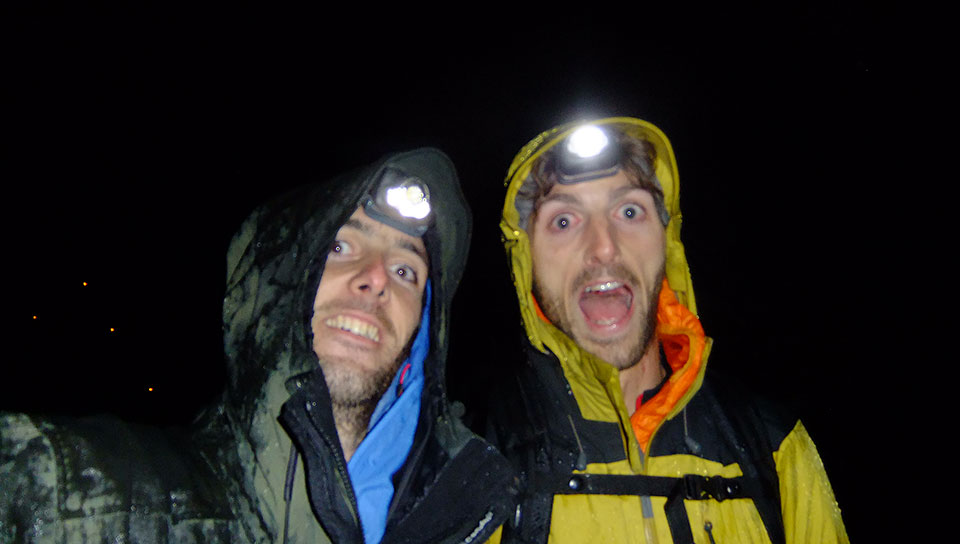
….. Day two – the tortoise and the hare. On the climb out of the Refuge des Mottets we’d been swapping stories and jokes with an Andorran trail-runner, out for a gentle jaunt around Mont Blanc. As he was on foot and we were mostly carrying our bikes it was only to be expected that he would say his farewells and trot off into the distance, on the flat and descents we would easily be quicker.

Climb to Col de la Seigne

Sure enough, we met him again as we dropped into Italy, the descent at first on open foot worn tracks with natural berms for every twist, then as we neared the refuge a wide 4×4 track which gave us the chance to fully appreciate what must be the most spectacular valley in the alps, Val Veni. Only then the front shifter on Sannys bike jammed.

We stopped and faffed.

Bike faff

Saying Hi as he passed, the Andorran caught up.

Sanny continuing with the new fashionable 1×10 set up for the rest of the trip, we caught our friend again, with another chat.

Did I mention Val Veni is spectacular? You can’t ride down it and not stop for photos. We said Hi again.

Val Veni

In the kids fable, the sure and steady tortoise eventually beats the impetuous hare. In real life, there was no such doubt as to the winner of the race. As we started the push up from the valley floor towards the Youla bowl we waved him off and could only wonder where he finished for the day….

Youla climb

Meters Climbed: 2435

Meters Singletrack descended: 1161

…..Descent espresso Our legs were starting to feel the effort of the last 12hr culmative riding, however there’s nothing quite like a movie perfect piece of trail to take your mind off them. I’d hoped the descent into Courmayeur would be worth the detour from the fast track along the valley floor, but I never thought it could be as good as it was.

Youla descent

Starting in the high alpine, the trail gently curved along the hillside, under the peaks used for the skiing Freeride World Tour. Eventually the trail started to swoop through thinly spaced trees, gradually thickening, but still keeping the fast and pumpy  feel . The briefest of climbs at the Col Checrouit passed without changing gear before Courmayeur appeared below us. Heading down the steeper winter pistes on a more switchbacky section of singletrack, we steadily lost height before more tree lined singletrack brought us out onto a 4×4 track Gaining speed on the fast and loose surface, plenty of JMC tribute hairpin drifts were had before the final section was spotted dropping off the edge of a bend.

Hard breaking, hanging off the back of the bike technical riding followed before we were spat out across the river from Courmayeur where the trail finished with some urban descending through narrow cobbled streets and down flights of steps. 1180 vertical meters and one of the best descents I’ve ever ridden, made even better by the obligatory stop for Italian food and drink.  Pizzas all round…..

Courmayeur descent, lower sectionPizza. (spotting a theme yet?)

Meters Climbed: 2830

Meters Singletrack descended: 2346

…..Tick, Tick, Tick. Boom. Yesterday’s odd noise from the rear hub had now manifested itself as something worse. On the descent into Courmayeur the free hub had started to occasionally stick meaning I had to keep pedalling to stop the chain dropping into the spokes, not a good thing less than half way round. Now, part way along Italian Val Ferret, I discovered there was enough friction in the hub to stop the wheel free turning after only a couple of rotations. This was why Sanny was a spec in the distance & enjoying himself whilst I grovelled my way up, nothing to do with him being fitter and me being on the verge of blowing. Knowing that it was a steady sit down and spin climb to the Elena Refuge, 880m above  Courmayeur, where I could buy coke, or beer, or even coke & beer, was pretty much all that was keeping me going.

The Elena refuge had closed that morning.

Sanny valiantly attempted to persuade them to re-open, using words that would’ve impressed British, German & French dockers, but not Italian. Probably why the doors didn’t open. There was nothing for it but to start pushing and humpfing the bikes up to Col Grand Ferret…..

Grand Col Ferret

Meters Climbed: 4187

Meters Singletrack descended: 2346

….Lucky cows. The drop into Switzerland from Grand Col Ferret had lived up to the standards we were now coming to expect, but there’d been nothing extra marking it out as special like the Bonhomme, Seigne & Courmayeur descents. We were nearing (or so we thought) the end of the singletrack & the Swiss Val Ferret road end where we would make speedy progress down the tarmac when, without thinking, we swung left.

Swiss Val Ferret descent, upper section

The path got narrower & took us along the valley, torn between concentrating on the narrow ribbon of trail & looking at the brilliantly named Marmontains hills around us. Eventually we started to head upwards &, with the road head now on the other side of the valley & some distance behind us, I accepted it may be time to consult the map. We’d taken the ‘wrong’ trail. Fortunately ‘wrong’ is a matter of perspective. The map showed the dashed black line would eventually rejoin the road just outside La Fouly, it was an easy choice to keep going.

Swiss Val Ferret descent, lower

“This is perfect singletrack”

Sanny was struggling to believe our luck.

“I told you the trails were better in Switzerland”

however he was still able to advance his argument of Verbier’s superiority to Chamonix trails. The trail did put forward a pretty good case. Quite how a trail so rideable, with so much flow, came to exist naturally I don’t know, but those Swiss cows obviously have more riding nous than we thought…..

Meters Climbed: 4227

Meters Singletrack descended: 3323

Descent to La Fouly

…..Fitter, happier and more productive. We arrived in La Fouly at 1805, hungry. With the in-built navigation system that suggests mountain bikers share more DNA with pigeons than most, we instantly found the village shop.

“Désole, il a  ferme a dix-huit heure”

Our looks of desperation were correctly interpreted and, before we had even begun to explain that you do not tell hungry Glaswegians they canny have the food infront of them, we were waved in with a “vite, vite!” Vite we were and moments later were consuming the traditional village shop bounty of bananas, chocolate and biscuits. With the first tier of Maslow’s hierarchy of needs satisfied we looked to the second, shelter. Sanny was all for pushing on down the road to Champex, but he was still feeling fit and had ridden the trails here before. I was not and had not, so was making the argument for stopping, happy to have the longer day tomorrow. Only where would we stay in La Fouly? I looked left and saw we were stood next to the Auberge I’d pencilled in for that nights stay. It seemed foolish to resist….

Meters Climbed: 4227

Meters Singletrack descended: 3323

Tour du Mont Blanc day 3

……It was a proper lightbulb moment! I don’t know what inspired it, the amazing breakfast or the surreal sculptures of the “walk of the mushrooms”  but suddenly a chain of thought occurred to me – the freehub’s knackered & I don’t want to walk back to Chamonix, high torque will only make it worse, straining up a hill in the granny ring is high torque. Therefore, I can get off and push up the hills and it’s not because the hill has defeated me, I am being a mature, reasoned rider- Get in!

The "mushroom walk". Indeed.

The breakfast was quite likely the cause of such genius thought. After the previous day’s misadventure where neither of us ate enough, we weren’t going to make the same mistake twice. “They have four types of cereal” may not be a statement to excite a seasoned business traveller, accustomed to the Hilton chains’ finest continental buffet breakfast, but most hut breakfasts consist of jam, stale bread and a bowl of coffee. “I’m eating all of them” declared Sanny and then did with much gusto. The couple next to us, walking the TdMB in a brisk 6 days, were chatting with us when conversation stopped & a look of joy spread across the man’s face. “you have to try the Ovaltiny!” we did “it’s like Maltesers, in a paste, on bread” A few sachets may have been purloined from the table for later in the day. Suitably fed and watered we’d waddled upstairs, collected our gear,   grabbed our bikes and headed out for our final day on the trail….

Meters Climbed: 4247

Meters Singletrack descended: 3895

La Fouly descent day 3

……Bovine, bull. The Bovine climb up from Champex has something of a reputation. it was one of the main reasons for us choosing to ride anti-clockwise on the TDMB and so hike the bikes up rather than carry them down this section. Out of Champex; possibly the most perfect Swiss village with its lake, clean quaint streets and cold war gun emplacements, a cunning detour kept us climbing on fire road, interspaced with short sharp descending on rooty single-tech trails. After gaining 200m , the fire road stopped and the trail began. It took us about 90 mins of hike a bike to get over this section, but it’s really not that bad. A few awkward steps to overcome, but nothing like the hell it had been suggested by the irritatingly smug guide back in La Fouly.

Boviner climb

It would be an interesting descent for sure and you’d want either Danny Hart or McAskill’s bikes (I assume you get the skill free when you buy the bike, that’s how it works isn’t it?) as the trail varies between full on rock garden DH to super precise trials between boulders. Definitely a challenge, and not one I’d want on a multi day ride with a light bike and heavy rucksack. There’s a reason every guided mtb route that goes clockwise misses this section out.

Bovine climb

At the opposite end of the scale, once we’d finished dragging the bikes up the bovine climb, the trail abruptly turned 90 degrees right and flattened out, we got back on the bikes for that rarest of incidences, a trail that rides better up hill than down. Part of this may have been that instead of staring at our feet, we were now looking across the Rhone valley, over Verbier and Crans Montana, and even out onto Lake Geneva, a view much easier to appreciate at uphill than downhill pace. Or maybe it was just the excitement of getting to ride the bikes rather than carry them! The rewards weren’t done yet either. Sanny had been briefed on how good the descent from Bovine down to the Col du Forclaz was, and I had a cheeky little track to get us from there down to Trient.

Descend from Boviner

With stunning views and blue skies, we set off down yet another cracking descent. Compared to the previous wooded descents it was much faster riding, with natural rollers setting the bike light into corners, lots of short sharp pedalling to make the most of the banked inside corners, and short sharp braking to steady the nerves on the unbanked, unprotected outside corners! All interspaced with sections of steeper and rootier terrain that needed the levers most of the way to the bar to negotiate, or in Sanny’s case, all the way to the bar as his bike had picked today to give up….

(more) Ice cream, in Trient this time

Meters Climbed: 5448

Meters Singletrack descended: 4844

……All over bar the eating.  I’d enjoyed the climb, the first of the route where I’d ridden the entire thing from metre 0 to metre 800. Just as well too, as it was the last of the route. Sanny hadn’t faired so well. A big crash the previous week had smashed a full face lid and front wheel, also resulting in some very tender ribs. His back was now coming out in sympathy and he was fairly relieved to see the Col du Posettes. Most people are. Even if you live in the valley, the view is something else. First the Chardonet comes into view, wow, what a mountain, then a little higher the Aiguille Vert & Dru’s, you forget the Chardonnet, look at them mountains! Then you get to see Mont Blanc itself, the axis for the ride. At this distance you really appreciate just how big it is. After the compulsory photo stop (go there, see the bit of trail, you’ll understand) we set off up for the final 100m or so of real climbing to the start of our last descent, which I knew wasn’t going to disappoint.

Climb to Le Jeurs

Col du Posettes, with Chardonnet & Vert

Meters Climbed: 6241

Meters Singletrack descended: 4844

The Aiguille des Posettes trail is well known by Chamonix bikers. I’ll admit to selling it a little short to Sanny, partly as the Chamonix v Verbier propaganda war, and partly because the first section promises more than it delivers with regular drainage bars crossing the trail.

Posettes trailPosettes trail descent

As the trail goes below the tree line, the bars stop and the riding gets better and better. Sanny was clearly enjoying it, but something was holding him back. His bike had become increasingly niche and, to compliment the 1×10 gearing (barely indexed now due to bent mech hanger) and cantilever esque braking, the forks had reduced in travel to 45mm to go with the 145mm at the back, all with a super steep headtube angle. A bit like a Proflex from the mid ‘90’s really. These problems couldn’t take the shine off the descent as we rolled through Frasserands & joined the Petit Balcon Nord for the mostly DH cruise into Chamonix where we could begin consuming our own bodyweight in junk food and beer. Even the degregration of Sannys bike, with the bolt through axle & saddle disintegrating on the way through town couldn’t stop us now…

Sanny's bike: no happy

Meters Climbed: 6351

Meters Singletrack descended: 5764

Petite Balcon

So what were the final scores?

Over the 3 days and 3 countries we’d ridden almost 150km, climbed 6351m and descended 5764m of singletrack. Broken 1 spoke, 1 rear hub, 1 saddle, 1 rear mech hanger, 1 front shifter unit, 1 fork, 2 brakes and had no punctures. Taken a combined 870 Photos and eaten more than we normally would in a week.

Refuge Nant Borant

Only you can’t measure a trip like this in figures:  It’s about the feeling of travelling a proper distance, one you can see on a big scale map; of not having to get back to the starting point that afternoon, but keeping going; and seeing the landscape change.

I’d aimed to get as much quality singletrack descending in without straying too much from the Cols and valleys taken by the normal walkers route, but never expected that the quality of the riding could be so consistently high.

So what are you waiting for…

Youla descent, Peutery behind

Lavancher action

Edit: Ignore all of the below, the mayor has announced that CdMB canny build a road up through either Lavancher or from Les Tines. Does this mean that community action works….

I wrote a while ago that the CdMB were proposing to create an access road through the Lavancher village and along the line of the current MTB track from Grand Montets to facilitate the new Plan Joran chairlift. Unsurprisingly there was a lot of local concern about this, as Lavancher village wasn’t built with large lorries in mind, and the new track would destroy the existing small trail.

Since then there has been some more local action, with a Facebook site (http://www.facebook.com/groups/237899679659718/) and online petition (http://www.petitions24.net/non_a_la_route_a_camions_du_lavancher_a_la_croix_de_lognan) created to help the community of Chamonix voice their concern.

So far the voices are being listened to, and Mayor Eric Fournier has asked CdMB to present a better case for the creation of a new road instead of the alternative options of using the existing access road, goods lift and helicopters.

The new chair will be built, but hopefully it won’t require the huge disruption to a small village, destruction of lots of natural forest habitat and, less importantly, the loss of one of the best official bike tracks in the valley.

worth keeping....

CdMB press release (and some Les Houches riding)

Black hidden trail, Les Houches

Read it here last! A little off the pace (I’ve been on holiday) and some time after everyone else has put it up, here’s an interesting press release from Compagnie du Mont Blanc about their commitment to biking:

Mountain biking in the Chamonix valley

Jump for joy...new trails in Chamonix. Maybe
Chamonix, August 3rd, 2012For three years now the Compagnie du Mont Blanc, aware of the ever increasing demand from mountain bikers, have made great efforts and significant improvements on the sites in the valley to offer mountain bikers more tracks to practice their favourite sport.The Balme area is particularly suited to this sport, so this year we have focused efforts on the creation of a new track off the Autannes chairlift.Here is up to date information on bike trails and areas in the valley:Balme : 3 tracks.
Piste de l’Ours Black track : from the top of the Vallorcine gondola down to Vallorcine.
Piste Océane Blue track : from the top of the Charamillon gondola back down to Le Tour. (Currently closed due to bad track conditions, a shaper will be called in next week)
Piste des Marmottes Green track : a new track from the top of the Autannes chairlift down to Charamillon (opening in August)
Bike patrol is on site from June to mid September.Flégère : 1 tracks not currently maintained but with open access.
Red track : which descends down to Le Praz.
The Compagnie du Mont Blanc has invested more than € 80 000 in recent years on the creation of mountain bike trails but it is clear that despite the massive investment, our company is not able to offer a suitable mountain bike area on this site. The decision has been made to waive any further investment on this site for mountain biking and focus our work on sites of Balme and Les Houches.Les Houches : No specific mountain bike tracks but a number of mountain bike trails are accessible.Brévent : No specific mountain bike tracks but a number of mountain bike trails are accessible.The work ahead is substantial, the Compagnie du Mont Blanc in partnership with the LH-SG (Prarion – Bellevue / Les Houches – St-Gervais) are currently working on the new plans for 2013.Rest assured that the Compagnie du Mont Blanc and the LH-SG are investing in the Balme and Les Houches sites to make the two sites dedicated to both amateur and professional mountain bikers.We hope, via this announcement, to prove that the Compagnie du Mont Blanc and the LH-SG Les Houches Saint Gervais, consider mountain biking as an activity with a future in the valley and that the two lift companies are currently working together on the development and preparation for 2013.The Compagnie du Mont Blanc’s operational team,will continue to communicate information on ongoing projects for 2013.We hope you enjoy your summer!

Perhaps more positively, CdMB have approached various folk in the valley to get their involvement and opinion on how to best work with mountain biking. Slightly worrying is the lack of comment on Grand Montets which currently has one of the best (and quietest) “natural” tracks accessible during the bike ban. Whilst the Flegere track is not going to get any more investment, CdMB seem happy for riders to maintain the track, and apparently tools will be lent out for anyone wanting to put in a bit of work. A word of caution from a few folk involved with CdMB at Le Tour and Les Houches is that negotiations for summer VTT tracks at both these areas is ongoing with land owners and new tracks getting built probably won’t help, so best keep to just track maintenance there!

Les Houches blue run

Anyway, excited by the prospect of 2 VTT friendly hills on the Chamonix annual pass next year, Lorne & I headed down to the Bellevue lift at Les Houches and discovered that whilst CdMB can give, they can also taketh away…

As seen on Bellevue

Or “MTB track permanently closed summer 2012. We’re looking at maybe making a MTB track from the Prarion telecabine for summer 2013”

Anyway, the old trails from the Bellevue are still in pretty good condition, though as ever they take a long, long time to dry. Three days after the last rain and still we were dodging puddles. The boardwalk sections are in poor nick (one section collapsed on us as we rode along!) and most, though not all, of the wooden features have been removed. An added wooden feature is the large tree from the April storms which is still blocking a fast lower section of the main blue trail.

Wallride

The best riding is probably on the assorted “black” sections which cut through the trees and have seen more maintenance from locals. Some of these sections can be pretty full on, so if it’s your first time through, there’s no shame in stopping to scope…..

After a few laps of the front we went for a run down to Les Houches. Tom (author of the Chamonix Bike Books) has raved about “Hugh’s way” for long enough, so having never ridden it, it seemed a good choice.

Hugh's wayJust waiting for a train

Unfortunately I was going off my memory and a pencil line amongst other pencil lines on my old map. As a result we had a few variations but, judging by the tyre tracks through the meadows, we weren’t the first, and probably won’t be the last. Suffice to say when Tom describes the “easy to miss” singletrack after the #8 piste marker pole, he’s being very accurate!

Bionassey

A great track nonetheless with lots of variety all 1175m of the way down, combined with a nice touristy train back up. If you’re looking to finish off your day at Les Houches with a run down to St Gervais bear in mind that the Tramway ISN’T included in the normal Chamonix biking lift pass, though is on your summer or annual pass. When you get to either the St Gervais or Le Fayet stations you’ll need to hand over your pass at the ticket desk to get a paper ticket for the train. Finally, it’s only the last 2 trams of the day that take bikes (although if they’re not busy you can usually get on trams earlier in the day) If all this seems to complicated, there’s always the normal train which runs from Le Fayet to Chamonix for about 5euro.

Half time analysis

Hero pose (photo Lorne Cameron)

It’s about ½ way through the bike season here in Chamonix, which means everyone’s discovering what that annoying squeak/rattle/creak has been for the last couple weeks as various parts give up or fall off after a few months abuse.

The trails are kinda the same with lots of bikes, but not much maintenance, going down. So how are things fairing around the valley?

Owen by Joel

Le Tour seems to be the in place to ride this season with the rarest of all things; occasional queues of bikes for the up lift! The front side is holding up well, the original DH track under the gondola is still the most accessible riding for all, being fun for beginner and faster riders alike. A few of the corners and braking areas are getting a little cut up, but nothing too bad. The new track that’s been cut under the chair is starting to ride in now and is a good introduction for folks new to bikes, but it’s not been designed to anything like the same standards as the other man made tracks up there. Still, it’s a new track and hopefully the first of a few up at Le Tour.

Les Jeurs descent

The natural trails are still excellent, though Posettes is VERY busy with walkers and definitely best left till after the bike ban ends to avoid any chance of the trail being completely lost for bikes. The new sign board at the refuge helpfully tells us that “walking trials (sic)… are for hikers only” and “in case of Mountain Bike accident, the authorities disclaim all responsibilities” as well as showing a picture of trail damage on the descent from the col towards Trient, all caused by bikes not weather and walkers apparently.

Col du Balme notice board (click to read)

Either way, it’s not a legal notice, but the excellent Les Jeurs descent is possibly better if you plan to take any of the singletrack down to Chatelard, Vallorcine, etc  and much less frequented by walkers.

Swiss trails above Chatelard

And the Vallorcine track? It’s getting a bit rutted in a few places, but nothing anyone who can ride the rest of the track can’t handle! The severity of the course has probably been what’s saved it from the braking bumps and skid trenches that beset easier tracks. Once again, big thanks out to the Vallorcine Mairie for creating this awesome run.

Grand Montets trails

Elsewhere the trails seem to be fairly quiet for bikes, and busy with walkers. Grand Montets has tyre tracks in the puddles, but I’ve not seen anyone up there, which is a shame as it’s the most “natural” of the official VTT trails during July & August. The track is in good condition, although there are still 2 trees down in the middle section. The 1st is duckable for the VERY short, and the 2nd now has a strategically place stone to let you ride over it.

Swoopy natural trails off the lift, what's not to like?

Flegere is a bit lost without its upper trails. They’re still there, but it’s not worth the pedal up to ride them. The lower track is holding up ok, but the puddles are definitely getting deeper when it’s rained

Prarion, not ALL tech....

Finally, hoping to find some nice steep riding away from the crowds, I took a look up the Prarion gondola at Les Houches. I certainly found the technical trails, though I also met a few walkers all of whom passed some form of “you’re mental” and “good luck” comment. Although this isn’t exempt from the bike ban, I don’t think it’ll ever suffer from excessive use. The trail is mostly very technical, with sections verging on pure trials, and others where, if you were very very lucky, a slip would only leave you very hurt and without a bike. It’s too tight to be able to just jump the hard sections on a big bike, so that option’s out as well. On the off chance then that Chris Akrigg (watch this if you’re not sure who or what I mean) reads this and needs a challenge…..